
I think most of you will remember how fascinated I am with remote places on planet Earth and that I often fly around in my Google Earthship looking for locations. There's something about standing on a street corner (using the Street View feature), looking around at buildings, streets, and people I never knew existed that turns me on. Sometimes, the Google cameras catch interesting glimpses into the life of a small town. Clothes hanging on a line, flower pots blooming on a front porch, a bicycle parked outside a back door. To be able to see these small scenes of every day life in places I've never heard of continues to capture my imagination.
 Vardø, Norway
70° 21' N., 31° 02' E
Vardø, Norway
70° 21' N., 31° 02' E
Vardø is the easternmost town in Norway. The port of Vardø, on the Barents Sea, remains ice-free year round due to the effect of the warm North Atlantic drift. Vardø is usually referred to as Norway's only mainland town in the Arctic climate zone, although this is not strictly correct since the town is in fact located on an island about 1 mile off the northeastern coast of the Varanger Peninsula. In July, the average temperature is 48 °F, while the January average is a modest 23 °F.
The Vardø area is well-known in birding circles for the great variety of bird species that can be seen, particularly at the Hornoya Nature Reserve, an island just outside the harbor. There is a single tree in Vardø, a rowan, which the residents protect each winter by building a house around it. Fishing and seafood processing remain Vardo's major economic sources of income.
Fortress: The Vardøhus Festning is a fortress dating back to the late 13th century, although the present structure dates from 1734. From the Google Earthship the fortress presents and interesting landmark.
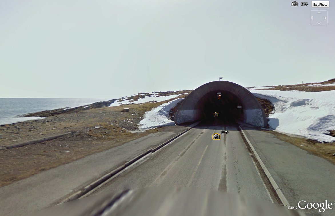
Tunnel: In 1982, Vardø was connected to the mainland by Norway’s first underwater tunnel, nearly two miles long.
Local Boy Makes Good:
John Norum, from the Metal group, Dokken.
Around Town: When I flew into Vardø, I landed at the corner of Grønnegata and Meyergata, an intersection just east of the main street. I like the way the boy with the bicycle and the guy by the dumpster just stand, looking at the Google camera car as it drives past. Up the street a man shovels snow. I'll bet they do a lot of that in Vardø.
This is on the main street, Strandgata. It is one of a handful of eating establishments, and the only bar I could locate. A woman pushes her pram on her way to somewhere. I was surprised to discover that the town has a Thai restaurant. Unfortunately, no pictures were taken of it.
On the left you see the town's bank, while up the street is the local church. I'll bet kroners to kippers it's a Lutheran church.
Farewell Vardø, and thanks for letting me drop in!

 I think most of you will remember how fascinated I am with remote places on planet Earth and that I often fly around in my Google Earthship looking for locations. There's something about standing on a street corner (using the Street View feature), looking around at buildings, streets, and people I never knew existed that turns me on. Sometimes, the Google cameras catch interesting glimpses into the life of a small town. Clothes hanging on a line, flower pots blooming on a front porch, a bicycle parked outside a back door. To be able to see these small scenes of every day life in places I've never heard of continues to capture my imagination.
 Vardø, Norway


Dave loves to travel via Google earth too.
ReplyDeleteFree wanderlust!
ReplyDeleteI have a friend who lives in Vardo. He's the editor of the local paper, which is housed in the red building across from the local bank, in your last picture.
ReplyDeleteHow cool is that. Go figure!
ReplyDelete